
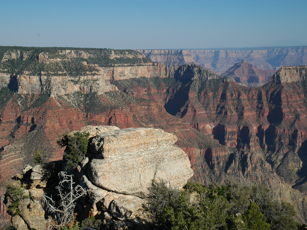
Great 8: Stunning Scenic Drives
I like to describe the view through the big windshield of a Winnebago as feeling like a big-screen movie of America is playing directly in front of me. And any time I wish, I can stop the film and simply enter the picture. That's pretty magical, especially when you're immersed in a jaw-dropping drive punctuated by myriad "Whoa!" moments. "The road is life," Jack Kerouac declared. Here are eight that will make you feel most alive:
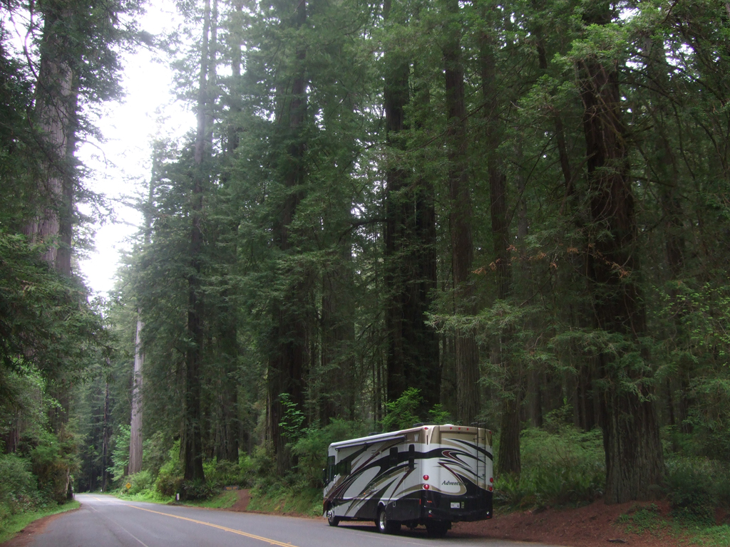
 Blue Ridge Parkway
It is satisfying enough simply to cruise along Skyline Drive, the 105-mile artery through Virginia's Shenandoah National Park, winding dramatically around the knobs and gaps of the Blue Ridge, offering breathtaking views (more than 70 overlooks) of the Shenandoah River valley to the west and Virginia's rolling Piedmont country to the east, past more than 300 buildings and structures listed on the National Register of Historic Places. But then you hit the Blue Ridge Parkway, and a grand drive turns into an epic journey along the eastern rampart of the Appalachian Mountains. And really, you should drive the whole dad-gum thing.
Millions visit the Parkway each year, whether in Virginia or North Carolina, but far fewer visitors opt to cover every one of its winding 469 miles--from Milepost 0 at the southern tip of Shenandoah National Park to its terminus at Smoky Mountains National Park. "America's Favorite Drive" offers scenic highlights with names like Craggy Gardens and Rocky Knob and Iron Mine Hollow and Grandfather Mountain; intriguing Appalachian hamlets like Buena Vista and Big Island and Blowing Rock; fleeting mountain hiccups called Little Switzerland and Meadows of Dan and Fancy Gap.
Stop for buckwheat, cornflower and sweet potato pancakes at Mabry Mill Restaurant (Milepost 176), site of century-old gristmill and a walking tour of rural life in Appalachia. Watch a banjo-and-dulcimer duo at the Roots of American Music exhibition at the Blue Ridge Music Center (Milepost 213). Hike a couple of miles to get remarkable glimpses of Linville Falls (Milepost 316). Nearly every bend in the road offers something to smile about.
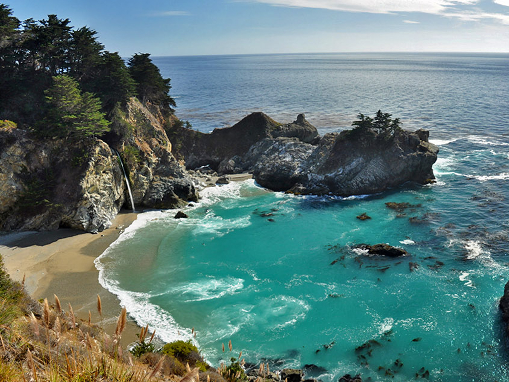 Big Sur Highway 1
Although it is also the name of a tiny village in the region, Big Sur has come to mean the 90-mile stretch of California's central coast between San Simeon to the south and Carmel to the north. It is a region of unmatched beauty where the Santa Lucia Mountains, Los Padres National Forest and the expansive blue waters of the Pacific Ocean join together in what is often touted as "the greatest meeting of land and sea in the world." This stretch of the Pacific Coast Highway feels very much like a journey along the edge of a continent, but it also offers some delicious stops along the way.
The scenery is a diverse collection of wonders. At Julia Pfeiffer Burns State Park, you can hike inland through the redwoods alongside a bubbling creek, or you can walk along the Overlook Trail and spot the creek's end -- 80-foot McWay falls plummeting from granite cliffs into the ocean. Andrew Molera State Park offers a mile-long hike past wildflowers and sycamore trees to a secluded beach sheltered from the wind. And the restaurants in Big Sur also give visitors the opportunity to chew the scenery. Deetjen's Big Sur Inn is a rustic old-world getaway among the tall trees that offers savory breakfasts and dinners. If you prefer the coastal view, sit on the terrace at Nepenthe--800 feet above the waves--and dive into the triple berry pie. The Big Sur River Inn offers seating by a huge stone fireplace on a deck overlooking bubbling rapids, a sound complemented by live music on Sundays.
Basically, it all combines to create an inviting spirit--down-to-earth simplicity with above-the-clouds serenity.
 Vermont Highway 7
A drive along Vermont's U.S. Route 7 might best be described as meandering through a series of picture postcards. Of course, the whole state might be described that way.
If you're starting from the north, you can begin in Burlington, where the scenery (Lake Champlain) is sublime and the vibe is laid-back-touristy. Then hop aboard Highway 7--through Shelburne and Charlotte and finally into Middlebury, which is a quintessentially quaint hamlet. This is prime strolling grounds, dominated by a white steeple, a waterfall and a gorgeous college campus. Eat dinner at the delightfully quirky Fire & Ice, named for a poem by Vermont native Robert Frost. And in fact, after dinner you can drive a dozen miles south and walk off the calories with another stroll--around the Robert Frost Interpretive Trail. It is a loop of slightly over a mile through woods and fields punctuated here and there with lines from several of Frost's poems. Poetry and scenery--pretty great combination
And speaking of visual arts, your Highway Seven Serenade can end with a stop in Bennington. Vermont's third largest city is home to one of the nation's smallest colleges. Fewer than 700 undergraduates attend Bennington College, which sits on a hill in an almost dreamlike setting. They're particularly dedicated to the arts at Bennington, mostly visual and performing arts. But surely someone is studying Frost, who took the road less traveled "and that has made all the difference."
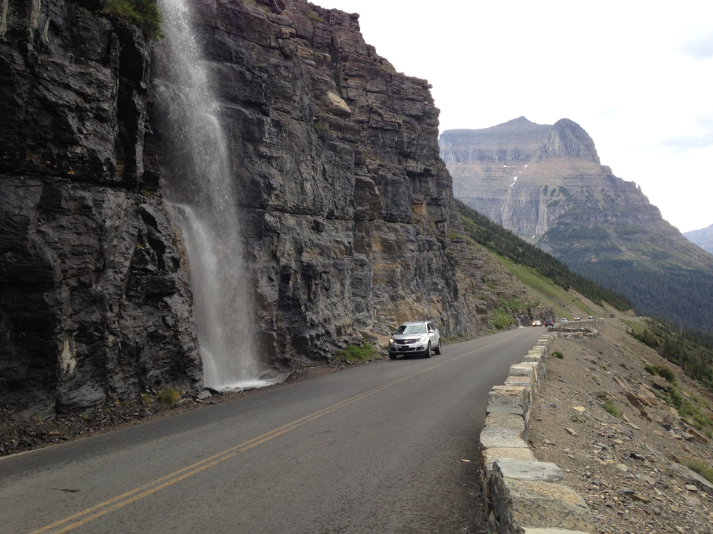 Going-to-the-Sun Road
It is almost impossible to describe the grandeur of the iconic road that takes you along the Crown of the Continent in Montana's Glacier National Park. The 50-mile long engineering marvel, completed in the 1930s, has been deemed a National Historic Landmark. Whether you're traversing it in a car, a narrated Red Bus Tour, or even one of the park's shuttle buses, it will surely be many things. It will be narrow, steep, winding, crowded... and almost unfathomably breathtaking.
The marvels are many. There is the Weeping Wall, where the waters rush down to the roadside like some sort of nature-made car wash. There is the Trail of Cedars, where your walk in the woods takes you beneath centuries-old trees. There is Lake McDonald, where the waters reflect cotton-ball clouds--along with Lake McDonald Lodge, more than a century old and offering what the locals describe as "a view with a room."
There are glimpses of glaciers (only about 25 remain in the park, half as many as only a few decades ago). There are sharp mountain ridges that seem to pierce the sky, as well as a lush river valley below, fed by waterfalls that cascade hundreds of feet. There are wildflowers adorning either side of the road--not to mention wildlife that occasionally crosses it. In fact, we had to stop suddenly to let a black bear wander through. Then again, it's his world. We're only passing through it.
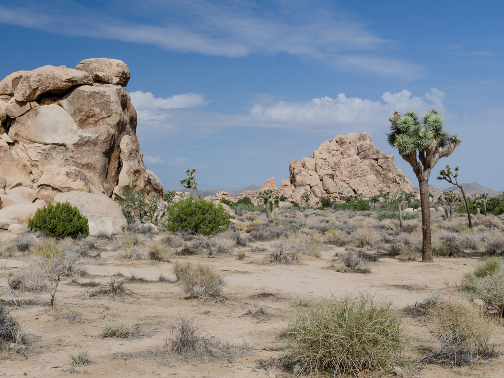
 Avenue of the Giants
It's just too majestic to be known simply as State Route 254 through Humboldt County. Is there any sight more awe-inspiring than a grove of redwoods while the sun filters through the canopies? This route through Humboldt Redwoods State Park (a 32-mile section of old Highway 101 that winds along the scenic Eel River and contains 17,000 acres of old-growth redwood forests) was originally built as a stagecoach and wagon road in the 1880s. Driving it is like steering among ancient giants who are standing guard by the roadside. Or maybe palace guards--the palace being Mount Olympus. It is beyond magical; it's almost mythological.
Avenue of the Giants is a tour of trees unlike any other. There are three drive-through trees (in the towns of Leggett, Myers Flat, and Klamath). The hamlet of Redcrest boasts the Eternal Tree House ("See 20' Room Inside Living Tree!"). Phillipsville is home to the Living Chimney Tree (and the Chimney Tree Grill). And, most famously, the Dyerville Giant, along the Founders Grove nature trail, measured at least 362 feet tall before it fell on March 24, 1991. That's like a centuries-old 30-story building toppling. Humboldt is humbling.
 Natchez Trace Parkway
The Natchez Trace Parkway--crossing through parts of Tennessee and Alabama before slicing a swath through much of Mississippi--is a 438-mile, two-lane highway meticulously maintained by the U.S. Park Service. But it began as a series of hunters' paths stretching from the banks of the lower Mississippi River to the Tennessee River Valley. By the 19th century, the crude Indian trail had evolved into a clearly marked path utilized by American farmers and traders. They would float their crops and products down the river to Natchez or New Orleans, sell their flatboats as lumber and then make the return trip on foot or horseback, most often along the trail from Natchez at the edge of the American frontier to Nashville and civilization. It was no easy proposition. The trail was infamous, known for its assassins, its land pirates, its malevolent innkeepers, and it soon earned a nickname: the Devil's Backbone.
The Trace is where American icons courted infamy--where former U.S. Vice-President Aaron Burr escaped to after killing Alexander Hamilton in a duel, where Meriwether Lewis shot himself at the age of 35. Despite the dangers, by 1810 the Trace was the most heavily traveled route in the Old Southwest. However, the arrival of the steamship as a safer and speedier means of transportation greatly diminished the importance of the overland route, returning a relative serenity to the path.
So the Natchez Trace today? It is both a scenic drive through history (Indian mounds, Civil War battlefields, Lewis's grave) and an historic trip through scenery (dense pine forests, murky bayous, golden pastures). And it's an inspiring combination.
 Salmon River Scenic Byway
The road begins (on its south end) at the town of Stanley (population 63, a mix that includes ranchers and river guides, many of whom like to describe this hamlet framed by the Sawtooth Mountains as a place that "awakens each morning to the freshest air on earth"). The road ends (on its north end) with a dramatic climb over Lolo Trail Pass and into Montana. Along the way the Salmon River Scenic Byway (highways 75 and 93) does, indeed, closely shadow the Salmon River--the River of No Return, as they call it. And, yes, the experience makes you want to stay.
It is a drive with eclectic opportunities. Visit history at the Sacajawea Interpretive Center and the Land of the Yankee Fork Historic Area. Take a short detour to ghost towns with names like Bonanza and Bayhorse, or stop for a spell in Clayton, Idaho ("population 7," says the sign). Soak your feet in Sunbeam Hot Springs, where the natural healing properties of a hot springs are diverted into the naturally spectacular river. Explore the historic city of Salmon. Or park yourself at the Challis Golf Course RV Park (in Challis, Idaho), where you may have nine holes all to yourself. You also can spend the night along the river at Wagonhammer RV Campground (two miles south of North Fork), which is a little slice of paradise amid a big swath of... paradise.
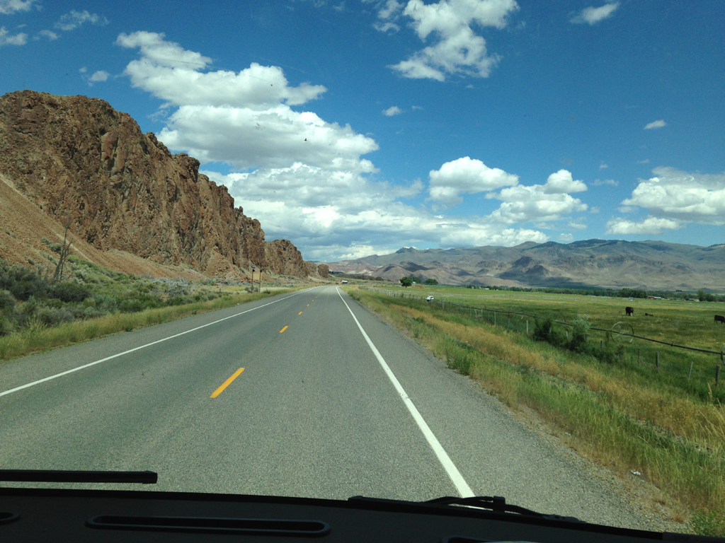
 Flaming Gorge Scenic Byway
Flaming Gorge National Recreation Area, established in 1968, contains more than 200,000 acres of land and water almost equally divided between southwestern Wyoming and northeastern Utah. The scenic byway--highways 191 and 44--essentially takes you along the circumference of Flaming Gorge Reservoir, which is famous for its trophy lake trout. The ride passes through high desert country, past sweeping landscapes and Crayola vistas-- green forests lush with evergreens and junipers, crystal blue waters, reddish-orange rock formations, salmon-colored cliffs.
In 1869 John Wesley Powell was exploring the Green River when he and nine men in small wooden boats came upon the region. They saw the sun reflecting off the red rocks. Thus they named it Flaming Gorge. About halfway along your journey you'll reach 502-foot-high Flaming Gorge Dam, which impounds the waters of the Green River. Thus the reservoir.
The best view along the byway requires only a brief detour to Red Canyon overlook along the south end of Flaming Gorge. There, you can watch a series of speedboats cruising through the deep blue waters in the gorge, leaving behind rippling wakes that seem to extend forever.
Comments
Comments on this post are moderated, so they will not appear instantly. All relevant questions and helpful notes are welcome! If you have a service inquiry or question related to your RV, please reach out to the customer care team directly using the phone numbers or contact form on this page .