An RV Road Trip on the Historic Natchez Trace Parkway
An RV Road Trip on the Historic Natchez Trace Parkway
Scenic overlooks, hiking trails, and thousands of years of history.
By: Sue Ann Jaffarian

Driving the scenic and historic Natchez Trace Parkway was one of the road trips on my travel bucket list. In fall of 2021 I finally made it happen.
The Natchez Trace Parkway is part of the National Parks Service. It is a scenic road, not quite 450 miles long, that meanders through beautiful scenery and historic sites as it follows closely along the Old Natchez Trace – a historic trade and travel corridor. It runs between Nashville, TN, and Natchez, MS. Along the way, it also dips into Alabama for a few miles.
Tip: There is a length restriction for RVs of 55 feet and that includes a tow vehicle. The height restriction is 14 feet. Some side roads are not RV friendly and are marked with signs warning of no circular turnarounds.
Planning an RV Road Trip on the Natchez Trace Parkway
This is not a speedy trip. Posted speed limits are between 30 and 40 miles per hour. Nor would you want to speed through it. I took me three days to drive it, stopping along the way to enjoy the beauty and learn more about the area’s fascinating history that dates back thousands of years. If you stop to hike the numerous trails, it could take much longer, but would be worth it.
The Natchez Trace Parkway has something for everyone. There are dozens of great hiking trails and trailheads along the drive, many of which follow along the original Natchez Trace. There are also many bike trails. As I drove along, I saw a few biking groups, including their support teams.
There are three free National Parks campsites for RVs and some designated only for tents and bicycle camping. These are all on a first-come-first-served basis. If you do not want to stay in one of the park campsites, there are roads leading to towns with RV parks, restaurants, and gas stations.

My History-Focused Natchez Trace RV Route
Scenic Overlooks & Historic Sites

The next stop was the War of 1812 Memorial. It is a monument set on a slight rise to remember the soldiers who died during that war and those who were buried along the Natchez Trace.
Next up was the Water Valley Overlook, with its great view of the valley and a lake. There were many overlook spots that took my breath away.
The Gordon House was next, which was once a private home and trading post along the Trace. It was not open to visitors.

After I took some photos here, I ducked into the ladies’ room. All along the parkway are nice clean bathrooms and picnic areas. When I came out there were two women in front of my van checking it out. One woman said she and her husband were very interested in something like my van. I gave them details on my Travato and answered a lot of questions, which is normal.
An Ill-Advised Adventure Off-Road
Next was another beautiful overlook of the valley, followed by an old tobacco farm. Behind the tobacco barn was a small road that wound through the woods. It was a two-mile section of the original Natchez Trace that you can drive on. RVs and buses are not allowed on it, but I took it since I’m in a van.
The deeper I got into the drive, the more I realized it might not have been the best decision. As cool as it was, I do not recommend it – even in a van. It was narrow, not much more than a cart path, which it originally was. My van fit, but I had to stay smack in the middle so I would not go into the shallow muddy gullies on either side. Fortunately, none of the overhanging trees were very low.

There was no place to turn around. None. It was a one-way two-mile commitment. If I got stuck, it was going to be difficult and expensive for someone to haul me out. I also had no connectivity, so if I got stuck, I would have to walk out to get help, wearing a walking boot.
Stupidity aside, I loved it! Crawling along I could get a real sense of the soldiers, traders and trappers, indigenous people, and the others that followed this path for hundreds and hundreds of years. I could easily picture slow-moving wagons rolling along between the trees. Finally, the road spilled me back out onto the parkway.
My final sightseeing spot of the first day was the Meriwether Lewis gravesite. Just a few yards from his impressive monument was the place where he took his own life. There is only a marker there as Gander Stand, the inn where he died, is gone.
There are some accounts that claim Meriwether Lewis was killed by bandits, but most historians believe he shot himself. Even two of his closest friends, William Clark and President Thomas Jefferson, believed he killed himself. He was only in his mid thirties when he died.
After viewing his grave, I went to the Meriwether Lewis Campground and settled in for the night. Only dry camping, but the sites were nice and roomy and the area gorgeous.

Natural Beauty Along the Parkway
My first stop the second day was Metal Ford, a place where in the 1820s pig iron was produced along the river. It was a pretty stop, complete with picnic tables. From there I meandered down the parkway. There were not as many historical sites along the drive. Mostly it was trailheads or places where hiking was involved to get to the sites.
Just before 10 a.m. I crossed into Alabama. Shortly after the state line marker the road was bordered by woods again and I saw a deer in the distance to my left. It was a bit ahead of me, so I slowed down, expecting it to cross the road. It did and brought along its friends. I came to a stop while nearly a dozen white-tailed deer ran across the road at top speed. It was beautiful to see them, their long slender legs churning, nearly flying across the road.

About 30 minutes later I pulled into the overlook at the Tennessee River. It was a lovely park with picnic tables and a gorgeous view of the river and the long bridge spanning it. If you are doing the trip, this is an excellent place to check for emails and make calls as the connectivity was great.
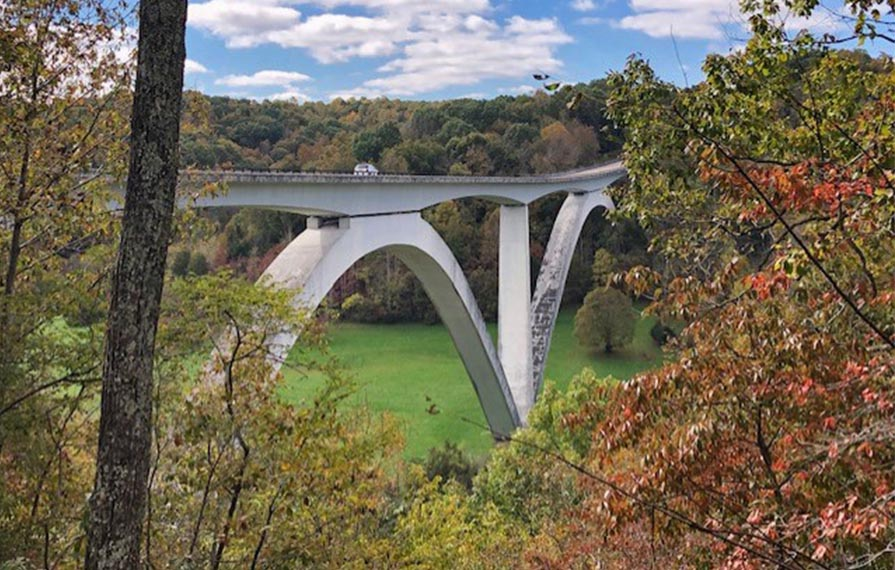
The next stop was the Tenn-Tom Waterway and Whitten Bridge. There is a parking lot where you can park and walk to the overlook for the bridge. There are also some very pretty sloughs near the parking lot.
Next came the Pharr Mounds, which I found very moving. These are mounds that were created 1800-2000 years ago. There were originally eight mounds spreading over 90 acres. According to the National Park info, the modern Chickasaw have a strong bond with these mounds and consider them sacred.
An overlook called Twenty Mile Bottom was next and it was very pretty.
Only one of the Parkway's information centers was open while I was there. It was just before Tupelo, MS. Construction work was being done along the parkway around the center, so there was a detour through Tupelo. Tupelo is a great place to stop for gas and lunch.
Shortly after I returned to the parkway, I stopped at the site of the Chickasaw Council House. The building is gone, but a nice picnic area now stands in the clearing.
I stopped at the Bynum Mounds next. These are the oldest mounds along the Natchez Trace and date from 100 BCE - 100 CE. There were originally six mounds at this site, but in the 1940s several were excavated and the two largest were rebuilt. The excavations yielded large amounts of exotic trade goods, evidencing extensive trade networking during that period.
A Scenic Second Half of the Parkway
When I came upon milepost 200, I felt it was a milestone in my journey. I had traveled just over half of the Natchez Trace Parkway and had 200 miles left to go. I really cannot recommend this trip enough. I did not stop everywhere along the way, just the highlights and things I could easily see.
My next campground was at milepost 193. Like the night prior’s campground, it is a National Parks campground and free, but it is small and the sites are not as spacious as at the Meriwether Lewis Campground. Some of the sites would be very difficult for larger rigs. From here ,the end of the parkway is about four hours away.
On my third day on the parkway, I came across several trailheads and nature walks. I stopped at Frenchman’s Camp, which was originally a stand that became an established village. It is still here today with a population of about 200. A stand was a place where travelers could stop and get food and a place to sleep for the night. They were often small buildings with a few rooms or as simple as a one-room cabin. They were usually operated by a married couple. They were all up and down the Natchez Trace, but none remain today, except for historical markers.
My next stop was Tupelo-Baldcypress Swamp. There is a short raised wooden trail here that I would love to have taken, but to access it you had to go down some steep steps. Same with a few other nearby sights, an old inn, and a school. They were not close to their parking lots and I was a bit hampered, but recommend checking them out if you are doing the parkway.

The overlook for the Ross Barnett Lake was wonderful! It was at milepost 105. The parking lot was up a slight hill. I stayed there a long time just soaking in the beauty. This lake is Mississippi’s largest source of drinking water. Before coming to the overlook, the parkway travels along the curved coastline.
My last day’s drive was just as beautiful as the other days, but different. There were more meadows and fields, including cotton fields. One of the highlights of my last day was seeing a bald eagle. It was several yards from the road dining on an animal carcass. When the car in front of me passed it, it flapped its wings. As I reached it, I caught the glorious sight of it taking off into the sky. A perfect ending to a wonderful road trip.
Comments
Comments on this post are moderated, so they will not appear instantly. All relevant questions and helpful notes are welcome! If you have a service inquiry or question related to your RV, please reach out to the customer care team directly using the phone numbers or contact form on this page .